COURSE MAP HISTORY
If you're interested in a bit of history about Cleckheaton Golf Course, below are three maps from the late1800s, early 1900s and from the 1930s. The Course was located to it's current location in 1922 from it's original home in Gomersal.
As a refence, here is a link to Google Maps to see what the area looks like today. CLICK >
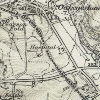
1800s
Chainbar Roundabout doesn't exist on any of these maps, which you can see on the below map as a crossroads.
There's a tramline that crosses onto the course location and across the Blakelock's mound, then under the 8th to 9th hole tunnel and onwards over the A58.
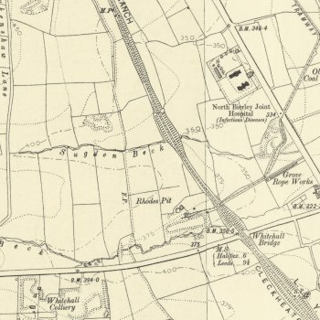
The offices next to where the Clubhouse is now, used to be an Infectious Disease Hospital, as you'll see on the 1900s map further down the page. Someone once told me golf was infectious, so it's not a bad place for it!!
You can clearly see the hut which is on your right hand side as you walk to the 11th tee and some buildings somewhere around the 16th tee with a track leading to them from the path at the back of the course.

Early 1900s
At the turn of the last century, the current Greenkeeper Sheds are now present as a Rope Works and the tramline is visible in more detail.
The current 11th tee can be clearly seen, which is a slag heap, probably from the 'Old Coal Pit' and/or 'Whitehall Colliery', which is now Beardsworths Nurseries. Next to it is 'Rhodes Pit' which is now the pond at the edge of the 8th.
The footpath is also visible, which is still used to this day and passes the 5th and 16th tee box mound.

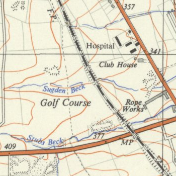
1930s
The golf course is now located on the map and you can see the Clubhouse, obviously a bit smaller than our current building.

Map Source: National Library of Scotland. CLICK >
